Cyclone Challenge Rides - Sunday 5 July 2026

- Cyclone Challenge
Rides
- Date: Sunday 5 July
2026
- Event HQ Location: Newcastle Red Bulls’ Kingston Park Stadium, Brunton Road, Kenton Bank Foot,
Newcastle upon Tyne NE13
8AF
- what3words location of car
park entrance - ///popped.jelly.bliss
- HQ
Parking - booking details coming
soon
- ENTER
RIDE
- Entries Close 30 June 2026
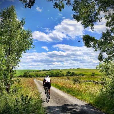
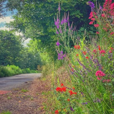
With four beautiful routes through the finest Northumberland landscapes, the Cyclone Challenge is one the must-do sportives of the UK cycling calendar. All four routes have been revised for 2026, with the longest (102 mile) option featuring over 20 miles of fresh roads, most of them spectacularly located in the wilds of Northumberland National Park.
The Event In Brief
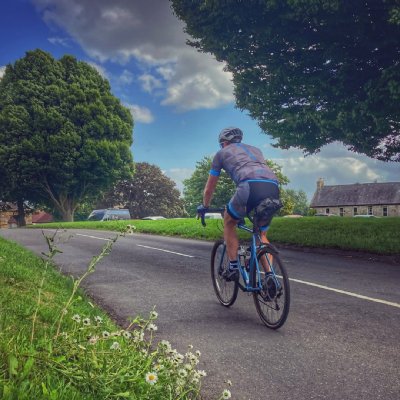
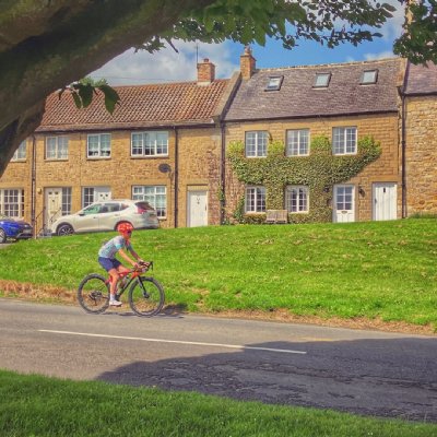
Starting from the spacious and well-equipped Newcastle Falcons Rugby stadium, on the edge of Newcastle-upon-Tyne, the Challenge Rides rapidly transport you into the picturesque and challenging landscapes of the Northumbria National Park: quiet roads take you along beautiful river valleys over remote moorlands and through pretty villages.
The 2026 event takes place on Sunday 5th July. Choose a route to suit your cycling ability, fitness, age and experience: there are 35, 66, 83 or 102 mile options.
Enter online and then simply turn up on the day and enjoy the ride, while we look after the rest. Plentiful parking (just off the A1), covered sign-on and facilities, electronic timing, mobile mechanical support and up to four feed stations mean you can concentrate on enjoying your ride on the quietest roads in England against the backdrop of lovely Northumbrian countryside. There are also lots of “top-up” culinary delights in several village halls (the local community embraces and welcomes the event and its riders) and a range of pubs on the routes.
New For 2026
Our routes have undergone a significant refresh for 2026. All four share 5 miles of new country lanes relatively early in the rides, around the hamlet of Shilvington. For the three longer routes, there's another very pretty new section of a couple of miles just north of Meldon.
All three longer rides also feature an attractive new run down from the top of the Ryals climb to the village of Matfen. This adds perhaps a mile and is on a couple of very quiet minor roads.
However, it's the longest ride (102 miles) that's had the biggest overhaul, incorporating over 20 miles of fresh roads. Most significant is the inclusion of the Gibbet climb, immediately after the feed at Elsdon, which opens up some exciting new opportunities soon afterwards: after descending past Harwood Forest, you'll soon be heading westwards for five miles on a beautiful single-track road past Sweethope Loughs, a section never used in the Cyclone before.
This then sets up riders for the exciting descent into Bellingham off Buteland Fell, which is a great favourite amongst local riders. Again, this is appearing in the Cyclone for the first time.
With further tweaks to the route on the approach to Wark (a lovely straight run across Wark Common before dropping into the village) and after the Birtley feed (5 miles of new route, parallel with the North Tyne river and through the pretty village of Barrasford), there's a real freshness to the revised route.
We've also shortened Route c from 93 to 83 miles, making it a more bridgeable gap between the 66 miles of Route B and 102 miles of the revised Route D.
The Four Routes
Ride A
35 miles (Green Route):
Designed for
families and riders who want to enjoy the countryside without any large hills.
The route is undulating, passing through a number of pretty villages, including
historic Stamfordham, where there is a feed station (plus the famous village
hall cafe). View
Map
Ride B
66 miles (Blue Route):
This ride is hilly and not without its challenges, but short
enough to enjoy if you're not a dedicated cyclist. for cyclists who want a
challenge. A little previous training is recommended as the ride ventures into
the hills of Northumberland, especially after the first feed. The Ryals climb
(featured in Another 100 Greatest Cycling Climbs), comes just before the final
feed and is the highlight of the ride for many. View
Map
Ride C 83 miles (Red Route):
This route has a distinctive flavour of its own, though it now shares the famous ascent of Winters Gibbet (one of the UK's 100 Greatest
Climbs) with the 102 mile route. The ride also includes the triple-ramped and famously steep Ryals
climb. With regular climbing throughout its 83 miles, the route requires good
levels of cycling fitness and experience. There are feed stations at regular
intervals, all well-stocked, plus cafes and village stalls at a number of other
points. View
Map
Ride D 102 miles (Black
Route): The toughest route and an excellent challenge for more
experienced cyclists. Extensively revised with 20-plus miles of new roads for 2026, this route is rolling throughout, with eight significant
climbs distributed through the mid section, with the deceptive and steep Ryals
providing a fitting climax to the serious ascents. To keep you going, there are
4 feed stations (not to mention numerous cafes and village hall tea rooms)
en-route. Riders competing this distance will have the additional challenge of
achieving Gold, Silver or Bronze Standard for their ride. The standards are set
as follows: Gold, under 6 hours; Silver, between 6 hours and 7 hours; Bronze,
over 7 hours. View
Map
Entry Fees
35 mile route: £30 (under-16 £15)
66 mile Route: £38 (under-16 £20)
83 mile route: £38
102 mile route: £38
Young riders - please read our special instructions for younger riders - Young Riders In The Challenge Rides

Navigation: We recommend all riders familiarise themselves with their route. Use a GPX file (we will email your GPX file with your final instructions), or carry a map. Although all routes are fully signed, occasionally signs have been removed maliciously - please have a backup plan. We advise you download and use the What3Words app to help us locate you, should you need to summon help.
The Rider Support Package
- Feed
Stations: All our Feed
Stations will be handing out water, energy
drinks, bars and bananas. These will
be plentiful and are free to all participants.
Many of our riders also take
advantage of the amazing selection of hot drinks
and cakes/sandwiches, made by
the local villagers and on offer around all four
routes. Feed stations are
located as follows:
- 35 miler: Stamfordham
- 66 miler: Forestburn Gate, Cambo, and Stamfordham
- 83 miler: Forestburn Gate, Elsdon, Cambo and Stamfordham
- 102 miler: Forestburn Gate, Elsdon, Birtley and Stamfordham
All Village Halls en route now accept card payments apart from Elsdon. However riders should carry some cash as they may stop at some places that do not accept cards. - Technical Support: Provided by Shimano
- First Aid: All Feed Stations will have First Aid Facilities and are in contact with Event HQ. A mobile ambulance will also be available. Summon help using the emergency number printed on your rider number.
- Timing/Tracking: We use electronic timing and timing chips to automatically record every rider's time. You will be able to download a certificate after completion of the event which will show your finishing time.
- En-Route: The National Escort Group (NEG) will provide motorcycle riders to supervise and monitor all four rides. Service cars will be provided to sweep the ride routes to identify any riders in need of mechanical assistance or recovery - use emergency number on your rider number to call in case of emergencies.
- Insurance: Every rider has event insurance from British Cycling, provided as part of their entry.
- Goody bag - at the finish for all riders.
- Parking - there are plenty of free parking options within a short ride of the start (but check local parking regulations very carefully). However, for a more relaxed start to your day book yourself a space on-site, yards from the event HQ and sign-on desks.
Registration & Start Times
Registration (number and chip collection)
- Option 1: Saturday 4th
July: 11am - 4pm
Location: Newburn Activity Centre, Grange Road, Newburn, Newcastle Upon Tyne NE15 8ND
what3words location ///tins.report.lasted
- Option 2: Sunday
5th
July: Registration opens
at 8am for the Ride D (102 miles). Registration for both Rides B & C
(83 & 66 miles) open
at 8.30am. Registration for Ride A (35 miles)
opens at 9.30am. Registration
closes 10.30am.
Location: Newcastle Red Bulls Kenton Park Stadium, Brunton Road, Kenton Bank Foot, Newcastle upon Tyne NE13 8AF - what3words location of car park entrance - ///popped.jelly.bliss
Start Times
- Ride D (102 miles) - from 8.30am
- Rides B&C (83 & 66 miles) - from 9.00am
- Ride A (35 miles) - from 10.00am